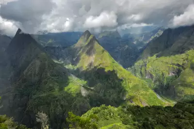
The crunch as my ankle turns inward is one I know only too well. I imagine the ligaments folding like origami. It’s less than a mile from where I’d planned to camp, on the banks of the Rivière des Galets in Mafate, Réunion Island, but my hobble there seems never-ending.
I’m miles from any road: the Cirque of Mafate has none, meaning that all supplies here have to be brought on foot or delivered by helicopter. A return journey by helicopter isn’t how I want to end this hike. This is only day four of the GR R2, and I’ve still got a week to go.
In the trail running world, Réunion is infamous. The Diagonale des Fous (translating as ‘Madmen’s Diagonal’) is often considered the toughest trail run in the world, and it’s similar in length and elevation gain to the GR R2. The fastest runners take about 24 hours to complete it, making the speed of my 11-day pilgrimage comparable to that of the giant African land snails I’d passed at a lower altitude.
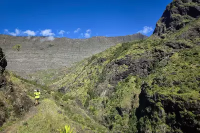
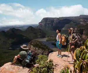
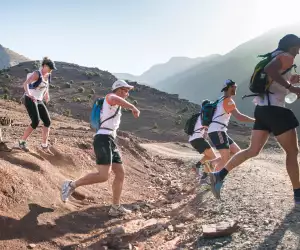
A hiker on Cirque de Mafate on Réunion Island
By the time I make it to the river, and a flattish beach with just enough space to pitch tents between the boulders, a lump the size of a Creme Egg has appeared. I peel off my hiking boot and plunge my foot in the river to ice it, and for a while, my replies to my hiking companions are monosyllabic.
I know I’m sulking, but this is the latest in a long line of ankle injuries to come about on hikes, trail runs, and, most recently, jumping off a rock on my last birthday (a stark reminder that 33-year-old bodies don’t bounce back as teenage ones do).
As the stars begin to appear and the pain in my ankle becomes a dull ache thanks to Nurofen and prolonged immersion in cold water, the immensity of the cliffs flanking our makeshift camp soothes me. The moon rises, so bright that it feels like an Arctic summer, the night an extension of the day.
It is 120 miles and takes around 12 days to complete the entire GR R2, from Saint-Denis, the island capital in the north, to Le Baril in the south, plus variants to the three summits (Roche Écrite, Piton des Neiges and Piton de la Fournaise).
The final summit, Piton de la Fournaise, is one of the most active volcanoes in the world
The final summit, Piton de la Fournaise, is one of the most active volcanoes in the world, and had been spewing lava repeatedly in the months leading up to my arrival, the most recent eruption just weeks earlier.
My brother-in-law Ugo, who lives in Saint-Denis, had sent me photos of a scarlet sky ablaze with volcanic fireworks. The variant to the summit was, therefore, understandably closed to any hiker who didn’t fancy becoming an ash mould with their Osprey pack forever sculpted to their back, knocking around 10 miles off our route. Ugo had become a last-minute addition to my hike, using his recent unemployment to his advantage.
On the trail, we’d picked up a pair of Belgians who camped with us throughout Mafate. They had the double advantage of being extremely funny and, their legs covered in bites, a far more effective mosquito repellent than the spray we’d brought with us.
We start early on the first day, a routine that continues throughout the hike. The sun sets a little before 6pm in Réunion in May, leaving little margin for error. Indicative times on trail panels are on the optimistic side, particularly in the south of the island, and in some places, they’re poorly marked. Luckily, my Suunto smartwatch vibrates violently whenever I deviate from a trail.
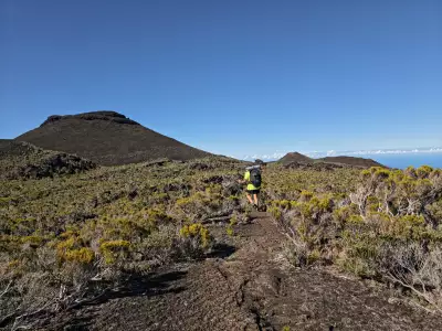
Volcanic terrain near Puys Ramond
At 6am, still wearing head torches as the first light makes its way over the city, we arrive at the trail start in La Providence, Saint-Denis, just over five miles from the airport I’d landed at the day before. Behind the wooden marker, with its distinctive red-and-white GR flag, the trail, an obstacle course of boulders and tree roots, climbs through subtropical rainforest.
Even this early, the humidity creates a film over my skin, and we have 1,800m of elevation gain to break in our legs. I try to avoid crushing the giant African land snails mooching over fallen leaves. Before long, it’s raining, but we’re sweating too much to see any sense in waterproofs.
Pearls of water form on the elaborate webs of red-legged orb-weaver spiders across the trail, their legs candy-striped black and pumpkin orange.
We arrive at our first stop, Refuge de la Roche Écrite, at lunchtime, and pitch our tents in a break between the showers. The refuge wardens rapidly ply us with rhum arrangé (flavoured rum) and start up a jam session on the kayamb (a Réunionese shaker instrument that looks like a straw table mat) and djembés (wooden African drums).
The party is in full swing when we crawl into our tents, the ground so saturated with water that the rain seems not just to be falling from the sky but travelling upwards, too.
We summit Roche Écrite, our first peak, at sunrise on the second day. None of the three summits (Roche Écrite, Piton des Neiges and Piton de la Fournaise) is included in the official GR R2 route; instead, they are proposed as variants that add around 20 miles in total to the regular itinerary.
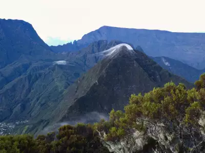
Roche Écrite on Réunion Island
If you didn’t give a toss about views, only about Strava stats, perhaps you’d skip them and shave off a couple of days, but that would be like going to a Michelin-starred restaurant and ordering a jacket potato. We’re above scudding clouds as the first rays of light touch the Indian Ocean, visible from our vantage point, and it’s far more dramatic than any viewpoint we’d had following the official trail on the first day.
So begins the cycle of climbing and descending and climbing and descending on repeat – there is no flat ground until day nine. On day three, a very long descent, several river crossings and a very long climb take us into the Cirque of Mafate for five days in a road-free utopia.
After the ankle mishap, I dose up on medication, and we yo-yo between villages painted every colour of the rainbow on the top of cliffs and waterfall-fed rivers at the valley floor. From the mid-17th to the mid-19th centuries, runaway slaves fled from the plantations to Mafate. The impenetrable mountains surrounding it were a natural barrier between former slaves and bounty hunters.
When we emerge from Mafate, and wild camping becomes more complicated, I swap tent life for the relative comfort of gîtes, where I fill my hollow hiker’s legs with home-cooked Réunionese food.
I wolf down breadfruit fritters, swordfish curry and banana bread still hot from the oven, chayote, a squash that tastes like courgette, baked in a cheesy gratin, and cucumber rougail, a Creole word for any kind of savoury mixture, which here turns out to be cucumbers macerated in a piquant sauce packed with fiery hot chillies.
The clouds swirl in when we arrive at Refuge de la Caverne Dufour on the eighth day, enveloping the building in a thick wall of white. It’s a necessary evil.
Unless you want to camp at the windy summit of Piton des Neiges, the highest point of Réunion and the volcano whose eruption formed the island millions of years ago, it’s the only place to stay. Wild camping anywhere else in the area is forbidden, so this lone building two miles before is the only option for most hikers.
Partly to avoid adding mileage to what promised to be an arduous section the following day, and partly to escape the smell of unwashed bodies asphyxiating the dorm rooms (there’s no running water here), we make a bid for sunset at the summit, leaving the other 80-plus hikers at the refuge to set heinously early alarms for sunrise.
Until this point, we’ve only met a handful of other people. In contrast, the full refuge feels like the Central Line at rush hour.
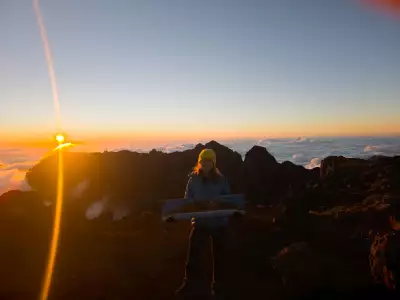
The writer at the summit of Piton des Neiges
Our risk is rewarded. Barely half an hour later, we break through the clouds, and not long after, we’re on top of the world. The surrounding peaks, bathed in golden light, make islands in cotton wool, and only four other people have braved the weather. The smug feeling lasts long after the treacherous shale descent back to the refuge by headtorch and moonlight.
When we arrive at La Plaine des Sables, the landscape becomes Martian. The arid flatlands of volcanic rock and shale are marked only by dirt roads that cut white ribbons like scars, and there’s no water to be found. The trail follows a ridge overlooking the tempestuous Piton de la Fournaise, and it’s the closest we’re currently allowed to go.
By day 11, all of the trail friends we’ve made have abandoned the hike, and the final stage, 15 miles and over 2,300m of elevation loss, threatens to send me home in a matchbox.
By the time we reach the trail end at Le Baril, my ankle has gone from Creme Egg to deluxe Easter egg, decorated with mottled bruising
We pick our way down volcanic shale for hours, followed by slick tree roots, and finally slippery, moss-covered boulders in a forest. By the time we reach the trail end at Le Baril, my ankle has gone from Creme Egg to deluxe Easter egg, decorated with mottled bruising.
It’s an anticlimactic finish to such a monumental adventure. The trail, cocooned in thick jungle foliage, abruptly vomits us out onto a highway, where a nondescript road sign points towards the southern start of the GR R2 and heralds our arrival.
An old woman is putting her bin out, and she looks at us as though that’s where we belong. We certainly smell as though we’ve spent 11 days marinating in a bin. Perhaps the lack of signage and fanfare is deliberate, though. On the return journey, which only takes two and a half hours along the coast road, the beaches we pass are full of tourists.
Just as they have for centuries, Réunion’s cirques effectively keep out the masses.
Anna was a guest of Île de la Réunion Tourisme. Plan your trip at reunion.fr